by Moin Islam11 min read
Real-time GPS tracking for last-mile fleets: how live tracking works and which platforms handle multi-driver operations
Driver 4 has not moved in 6 minutes. Driver 7 is two stops ahead. An Uber Direct courier has the order your customer is calling about. With 1 driver, you send a text. With 12, the map has to tell the truth.
Real-time GPS tracking shows dispatchers where active drivers are, recalculates ETAs as routes change, and gives customers a limited view of the final approach. It becomes a fleet system once it can track 5+ drivers, separate locations and teams, and keep in-house and third-party orders in one view.
Basic route visibility shows what should happen. Fleet tracking shows what is happening across every driver, location, and delivery provider—and gives dispatch time to change it.
How does live GPS tracking actually work?
Live delivery tracking starts in the driver's phone, not the dispatcher's map. The app requests a location from iOS or Android, attaches a timestamp and driver ID, sends it over the mobile network, and plots the latest point in the delivery platform.
Phones use more than GPS. Apple's Core Location framework can combine GPS, Wi-Fi, cellular, Bluetooth, and motion sensors to update the driver marker and ETA.
Four clocks control what the dispatcher sees:
- The phone's location-request interval
- The operating system's decision to return an update
- The mobile connection's upload time
- The dashboard's refresh time
"Real time" does not mean continuous. It means current enough to support dispatch decisions.
How often should a driver's location update?
A moving delivery driver should appear current within about 30–60 seconds for active dispatch, while a point older than 2 minutes should be treated as stale. Ping interval isn't the same as marker age, and none of the 7 platforms compared below publishes a fixed production interval.
Shipday's FAQ gives one useful clue: a driver turns red on the dispatch dashboard when the location hasn't updated for more than 2 minutes — a stale-location warning, not a ping-interval spec.
Faster isn't always better. A 1-second request rate would burn power, use more data, and create noise from tiny location changes. Apple tells developers to minimize update frequency and request only the accuracy the task needs.
Ask every vendor for 3 numbers in a live test: marker age while moving, time to flag a stale driver, and recovery time after reconnection. If they can't answer in the demo, they won't answer after you've signed.
Why do GPS points drift?
GPS drift happens because a phone estimates position from signals that shift with buildings, weather, hardware, permissions, and movement. A driver can appear across the street to be inside a body of water without ever leaving the road.
Each point should carry an accuracy value — high-rise streets, garages, warehouses, and weak-signal areas need more tolerance than an open road. One bad dot, even temporary, shouldn't trigger a failed-delivery accusation.
Geofences need the same restraint: a 10-meter boundary may look precise on a setup screen and fail at the loading dock. Start around 50–100 meters for arrival events and tighten only once the data supports it.
A dot is an estimate, but it can be unreliable. The timestamp and accuracy are the actual evidence.
How does live tracking affect phone battery?
Location tracking drains more battery when the app asks for high accuracy, pings frequently, or runs in the background all shift. Navigation, messaging, camera use, a bright screen, and weak cellular service add to the drain.
Apple says high-accuracy location work uses multiple phone systems and background updates increase energy use. Delivery-software vendors describe location tracking as inherently battery intensive and consistently recommend keeping driver phones on a charger — some warn that power-saving mode can pause background GPS entirely.
Give every driver a charger, require background location permission, exempt the app from Android battery optimization, and train drivers not to force-close it.
The best ping interval is worthless when the phone dies in the middle of the ninth stop.
What happens when a driver loses signal?
When a driver loses service, the dashboard shows the last point it received. A good driver app keeps the route offline, stores activity on the phone, then syncs after reconnection — though prolonged disconnection can still cause data loss.
No platform should draw an invented road path between 2 valid points and call it the route. That gap is an estimate, and it should be labeled as one.
The dashboard should show the last-update time, not a driver pin with false confidence — dispatchers need to know when the map stopped knowing.
What should dispatchers, customers, and drivers see?
Each user needs a different tracking view — the dispatcher's map creates clutter for customers and privacy risk for drivers.
Dispatchers need active drivers, marker age, order status, route progress, late-stop alerts, unassigned work, reassignment, and filters.
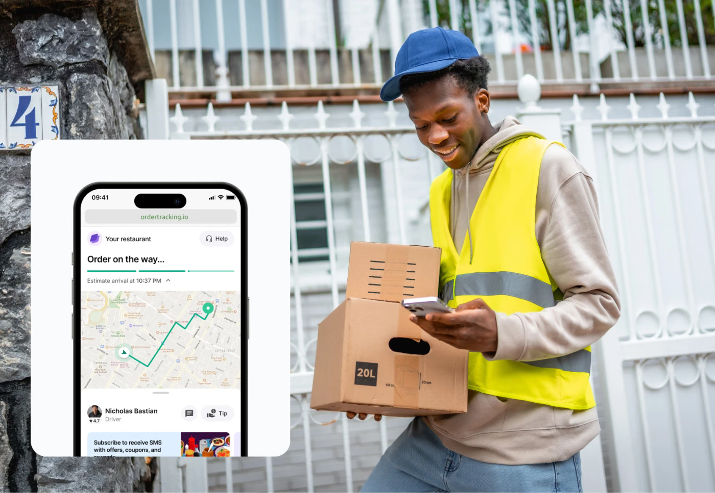
Customers need order status, ETA, a map near arrival, contact options, and proof. The strongest customer views surface the driver's location only in the final stretch before arrival and hide it again once the delivery completes.
Drivers need the next stop, route, notes, contact tools, proof steps, and clear notice of when tracking starts and stops.
Privacy is part of fleet scale — track the shift, not the person's evening.
Can one dashboard track in-house and third-party drivers?
One dashboard can manage in-house and third-party deliveries only if the platform integrates with the outside courier's status and tracking data. The business does not control the third-party driver's phone or ping interval, so visibility depends on what DoorDash Drive, Uber Direct, Roadie, or another provider exposes. At that point you're renting someone else's eyes, not buying your own.
Shipday lets businesses dispatch to their own drivers or services such as DoorDash and Uber from one workflow, with API support for third-party quotes and assignment.
That doesn't make both tracking feeds identical. An in-house app may show a continuous driver trail; a courier integration may only offer status events, an ETA, or a provider link. Ask what the dispatcher sees before pickup, during the trip, and after completion.
"Integrated" can mean one button to order a courier. It does not always mean one live dot.
How do geofencing and automatic status updates work?
A geofence draws a virtual boundary around a pickup, stop, depot, or service area and fires an event when the phone crosses it. Fleets use it to record arrival, start service time, notify a customer, or stop a driver from completing an order far from the address.
Implementation varies by platform. Some publish automatic check-in and check-out on arrival. Others offer geofence-based service start and completion, sometimes still in beta. A few can warn a driver who's outside a configured radius, though the driver can typically still proceed anyway.
Use automatic events for low-risk steps and keep proof of delivery separate — entering a 75-meter circle proves proximity, not that the right customer got the right order.
Geofencing removes taps. It does not remove judgment.
Why must route optimization and live tracking share a system?
Route optimization creates the plan; live tracking supplies the conditions that should change it. When they share a system, a late pickup, closed road, new order, or missing driver can update ETAs and stop sequence without rebuilding the day elsewhere.
Shipday route planning combines multi-stop routes with real-time tracking and sends route changes to the driver app. Elsewhere in the category, some platforms recalculate future job times from GPS positions, driving speed, and actual stop progress; others update ETAs and can display a new stop sequence mid-route. This kind of live re-optimization is what keeps a route efficient once the day stops going to plan.
Two disconnected systems can each be accurate and still disagree about what happens next. The dispatcher gets the argument.
How should multi-location fleets be organized?
A multi-location system should give each site its own orders, drivers, permissions, and view while regional leaders see the network. One unfiltered map fails as soon as 3 stores share it.
Organize drivers by location or team, with filters for shift, route, provider, and exceptions. Regional users need cross-site comparisons; local managers need control of their own shift.
Shipday advertises an enterprise dashboard for multiple locations on its Business AI tier. Elsewhere in the category, some platforms support multiple workspaces and depots out of the box; others reserve multi-region controls for their top enterprise tier.
Centralized does not mean flattened. The right dashboard lets each store work and headquarters see.
How GPS tracking platforms compare in 2026
No approved platform publishes a fixed GPS ping interval or a measured battery-use percentage. The honest comparison is whether the vendor documents live tracking, stale-state behavior, background requirements, customer visibility, geofencing, mixed-fleet support, driver limits, and price. Everything else on a vendor's site is a sales pitch wearing a spec sheet.
| Platform | Published ping interval | Battery / background guidance | Third-party fleet visibility | Geofencing | Live customer link | Driver limit on entry plan | Public starting price checked Aug. 21, 2026 |
|---|---|---|---|---|---|---|---|
| Shipday | Not published; flags location stale after 2 minutes | Background GPS required; measured impact not published | Yes for supported on-demand providers; feed depth varies by provider | Geo-fencing listed on Business and AI | Yes, live map and ETA | 10 drivers on free plan | Free up to 300 orders/mo; Professional $39/mo |
| Onfleet | Not published | Always-on permission; recommends charging during use | Not a published mixed on-demand fleet feature | Completion and service-area controls vary by plan/add-on | Yes | Unlimited users; task limits by plan | Launch $619/mo for 2,500 tasks |
| Spoke Dispatch | Not published | Not publicly documented | Not publicly documented | Listed in third-party directories; official detail not located | Yes | Not publicly documented | No current official public price verified |
| Track-POD | Not published | Background and measured battery impact not published | Not publicly documented | Yes; automatic check-in/out and completion controls | Yes, branded URL and live ETA | 3-driver minimum on driver plans | Advanced $59/driver/mo monthly |
| Detrack | Not published | Detailed charging permission, and battery-optimization guidance | Can accept outsourced jobs; unified outside-carrier orders not documented | Yes; configurable distance warning | Yes | 1 driver app per paid vehicle | Pro $29/vehicle/mo |
| OptimoRoute | Not published | Always-on background permission required | Not publicly documented | Auto start/complete on beta on Pro and Custom | Yes, live ETA | Priced per driver | Lite $35.10/driver/mo annually; Pro $44.10 |
| Routific | Not published | Always-on permission; offline route sync documented | Not publicly documented | Completion-location capture; 100-meter warning announced, not enforcement | Yes; approaching-driver view | Unlimited drivers | Free up to 100 orders/mo; $150/mo up to 1,000 |
Shipday fits small and hybrid fleets at a low entry price. Onfleet gives larger operators a mature command view. Track-POD and OptimoRoute publish deeper geofence controls; Detrack documents phone failures well. Routific includes unlimited drivers and a clear customer tracker. Spoke Dispatch leaves more technical questions for the demo.
Frequently asked questions
Which delivery management software has the best real-time GPS tracking for fleets?
Onfleet has a strong command view for larger fleets; Track-POD and OptimoRoute publish detailed route, ETA, and geofence controls. Shipday fits small and mixed fleets managing in-house and supported third-party drivers in one workflow. No major platform here publishes a fixed ping interval — test marker age and stale alerts during a trial.
What is the best delivery management software for last-mile fleets?
It depends on fleet size and operating model. Shipday covers small businesses and hybrid fleets at a low entry price. Onfleet fits higher-volume operations needing command-center controls. Track-POD and OptimoRoute go deeper on planned routes and geofencing; Routific offers unlimited drivers with volume pricing.
Which delivery software combines route optimization with real-time tracking?
Shipday, Onfleet, Track-POD, Detrack Advanced, OptimoRoute, Routific, and Spoke Dispatch all combine route planning with live tracking. The difference is what happens after dispatch — whether new information recalculates ETAs, changes stop order, and updates the customer link. Test a late pickup before treating checked feature boxes as one connected workflow.
How often does delivery tracking update a driver's location?
Most platforms don't publish a fixed ping interval. For active dispatch, a moving driver should appear current within about 30–60 seconds, and dispatchers should treat a marker older than 2 minutes as stale. Phone settings, background permissions, and signal strength all affect the visible age.
Can you track third-party delivery drivers in the same dashboard?
Yes, if the platform integrates with the third-party provider's tracking or status data. Shipday supports dispatch to services including DoorDash and Uber in the same workflow, though visibility may still differ from an in-house driver app — expect status events or a provider link instead of a continuous trail.

Moin IslamCo-founder, CEO
Automating local deliveries globally. Writes about restaurant delivery management, growing delivery business, and managing profitable restaurants.